GeoPulseNet: A Distributed Vibro-seismic Sensor Network for Real-Time Subsurface Mapping in Disaster Zones
Abstract:
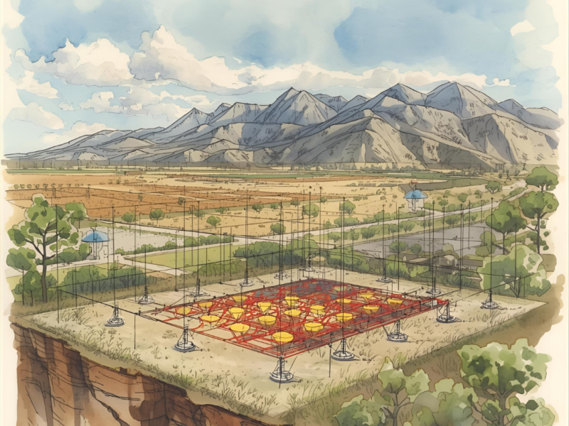
Rapid and accurate subsurface imaging is critical in post-disaster scenarios such as landslides, earthquakes, and minefield detection. This research introduces GeoPulseNet, a novel distributed sensor network composed of ultra-compact nodes capable of both emitting and receiving vibro-seismic pulses. Unlike traditional geophysical systems, GeoPulseNet leverages
cooperative signal triangulation across a mesh of autonomous units to construct dynamic, highresolution maps of underground structures in real time. Each node integrates piezoelectric actuators, geophones, and low-power wireless communication modules, enabling scalable deployment across complex terrains. The system’s active probing mechanism, combined with AI-driven signal interpretation, allows for detection of voids, buried objects, and density anomalies with minimal human intervention. Field simulations demonstrate its potential for search-and-rescue operations, landmine detection, and geotechnical monitoring. GeoPulseNet represents a paradigm shift in terrain intelligence—transforming passive sensing into an active, adaptive, and life-saving technology.
Skills and experience required for the project:
Geotechnical and Computer Engineering, Coding (i.e., C++, Python), Data acquisition and logging
Apply Now